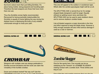
Do you know where to go when the zombie apocalypse arrives? The Internet will be among the first services to fail so Google is out of the question, but these handy Zombie Safe Zone Maps can guide you to safety, even without the Internet, smartphones, or electricity.
If The Walking Dead has taught us anything, it’s that things like running water and electricity will become a thing of the past when the dead start craving fresh meat. Fortunately, these artistic pieces can guide you to safety when wall decorations become less of a priority.
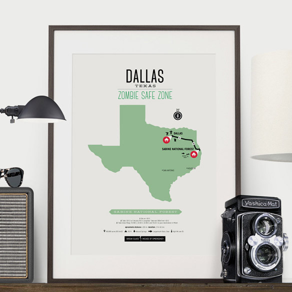
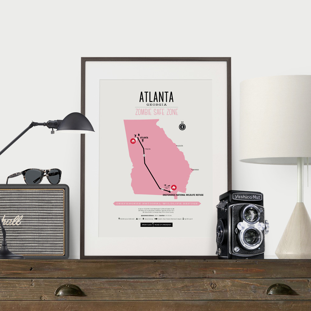
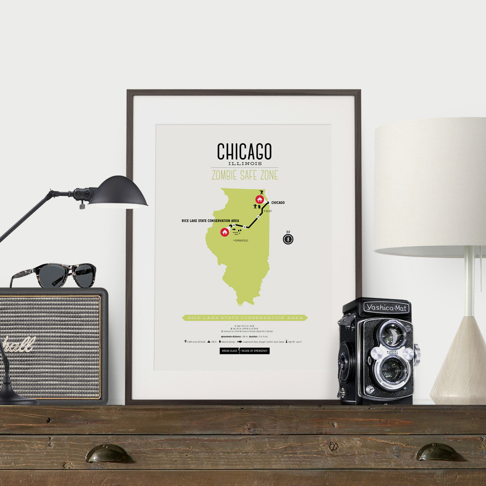
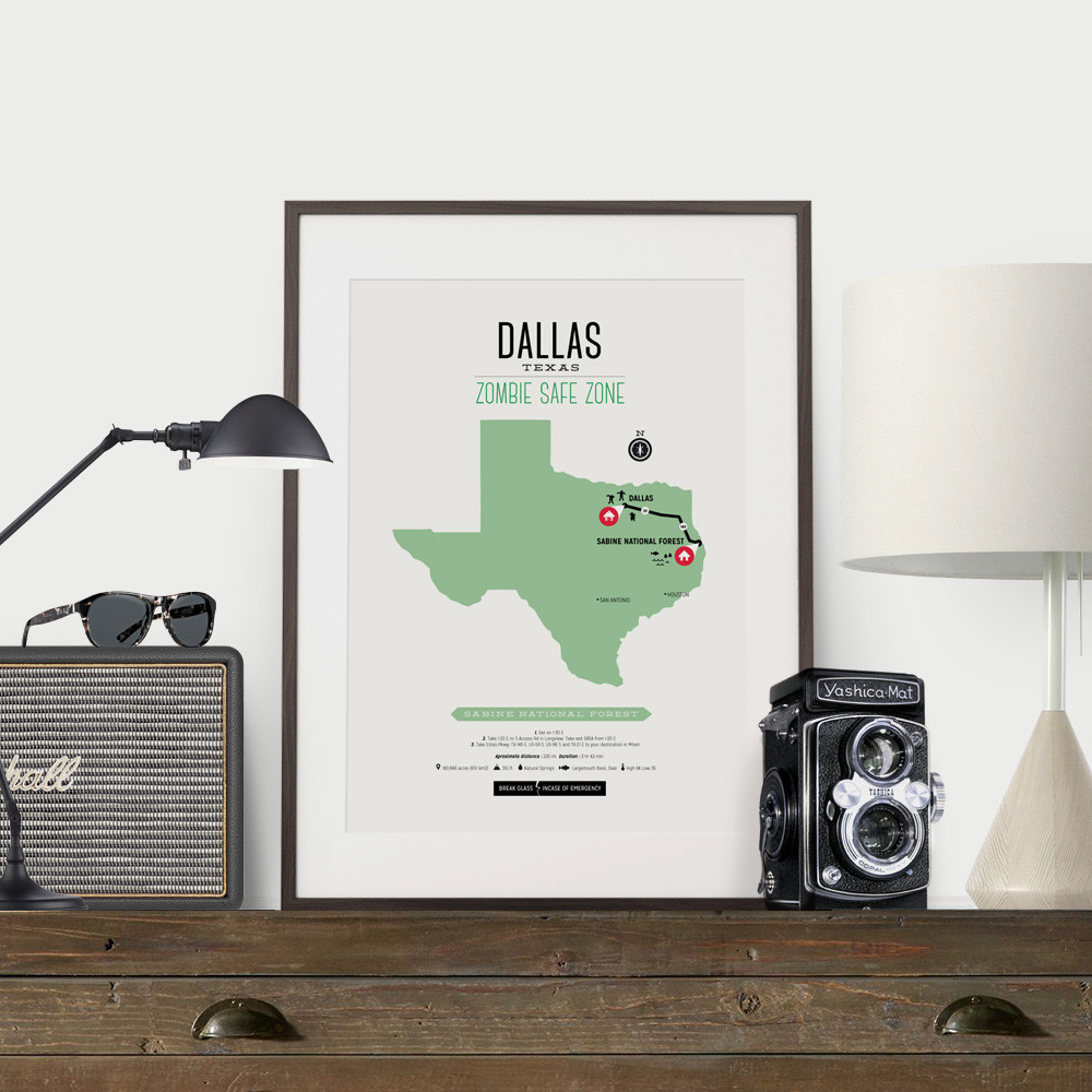
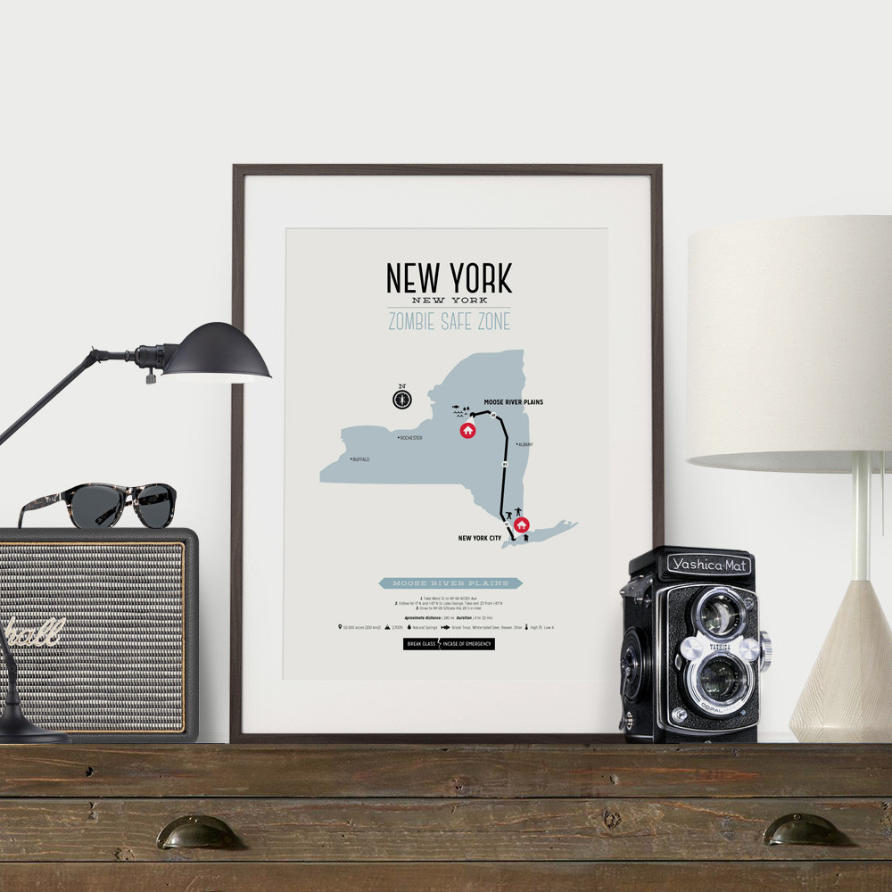
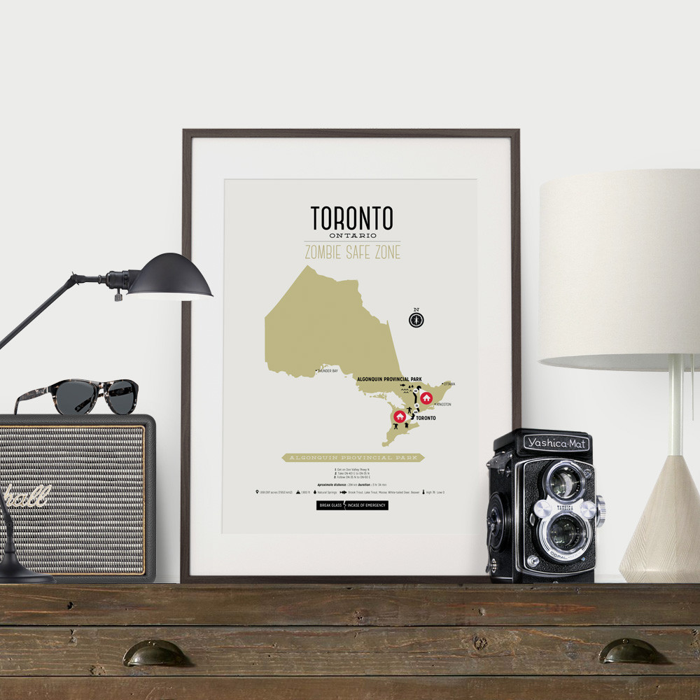
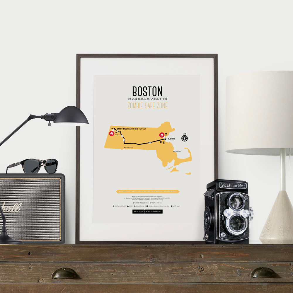
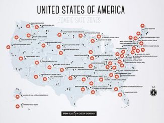
Each map guides you from your zombie-ravaged home to a location that offers food, protection, and water, providing directions, approximate distance, and how long it will take to get there. The maps come in a wide variety of colors and are available for Atlanta, Boston, Chicago, Dallas, Detroit, New York, Philadelphia, San Francisco, and Toronto.
Don’t panic if your city isn’t listed because you can have a custom map made for your area.
SIZES AVAILABLE
- 8 x 10 inches
- 8.3 x 11.7 inches (A4)
- 11 x 14 inches
- 11.7 x 16.5 inches (A3)
- 12 x 16 inches
- 13 x 19 inches
COLOURS AVAILABLE
- Pink
- Mustard
- Green
- Turquoise
- Steel Blue
- Tan
- Olive
- Mint
- Sea Grass
—————————–
*All our prints include a slim 1/4″ white border and are printed on a heavy weight 240gsm archival matte paper.
Zombie Safe Zone Maps are available for $19.99 – $24.99 at Design Different. A custom map can be made starting from $39.99.


Leave a Reply